
XVISION COMMAND
COMMAND · ROAD LOCATION WORKSPACE
Traffic questions.Defensible answers.
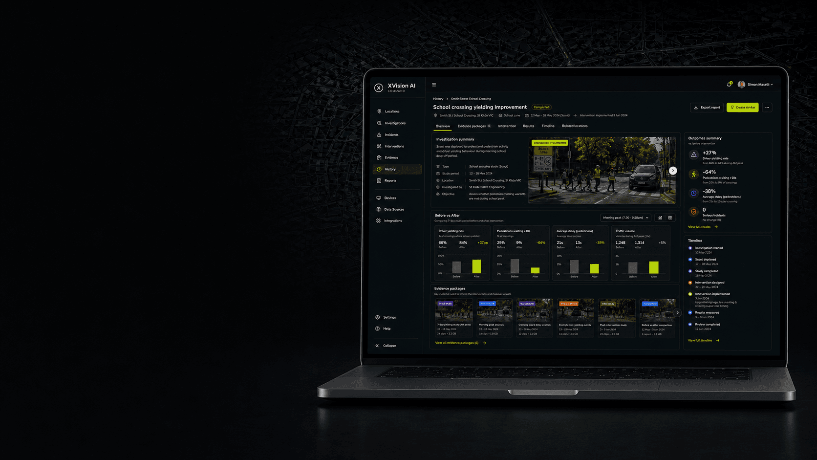
Command brings traffic data, video, investigations, evidence and reports together around each road location—so traffic and transport teams can move from question to defensible answer. Use existing cameras and roadside systems, then add XVision hardware where visibility is missing.
From traffic question to engineering decision.
Command keeps the work connected.
Command gives councils, road agencies, survey providers and consultants one location-based workspace for turning traffic questions into evidence, reports and measured outcomes.
COUNCILS
I need to resolve traffic complaints and justify interventions.
ROAD AGENCIES
I need to coordinate repeatable investigations across the network.
SURVEY PROVIDERS
I need to deliver complete, client-ready evidence packages.
CONSULTANTS
I need to turn mixed transport data into defensible engineering reports.
One location. The complete record.
From question to measured outcome.
Command organises the data, investigations, evidence, interventions and reports for each road location. Teams can see what was asked, what the evidence showed, what changed and whether it worked—without replacing the systems already in use.
Location record
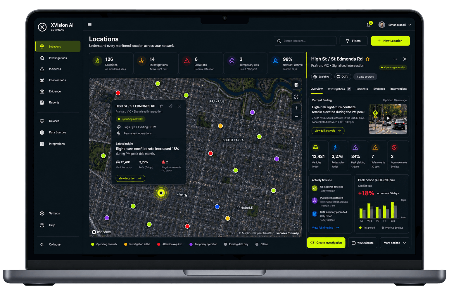
Keep investigations, incidents, assets and previous studies connected to one enduring road-location record.
Connected data sources
Bring together existing CCTV, traffic counts, connected vehicle data, uploads and XVision intelligence.
Investigations & findings
Start with the engineering question and reach a clear finding supported by the underlying data.
Evidence packages
Keep video clips, images, charts, observations and notes connected to the investigation.
Interventions & timeline
Record what changed and preserve the decisions, activity and evidence that led to it.
Reports & outcomes
Generate engineering outputs and compare before and after without rebuilding the work.
Follow the work from question to outcome.
Keep every step connected to the location.
Command keeps the question, observation, finding, evidence, decision, intervention and outcome connected to one road location. Teams can see how the answer was reached, what changed and whether it worked.
Location workflow
High St / St Edmonds Rd
Why are drivers not yielding during the school peak?
01
QUESTION RAISED
Unsafe crossing behaviour reported
The location, issue and engineering question are recorded.
02
OBSERVE
Existing CCTV + connected vehicle data + Scout
Available evidence is reviewed and Scout closes the real-time and behavioural visibility gap.
03
FINDING
84% yielding · 11 high-risk interactions
The PM peak pattern and physical risk context are established.
04
EVIDENCE PACKAGE
Video, charts + observations connected
The material supporting the finding is organised into one reviewable record.
05
ENGINEERING DECISION
Raised crossing approved
The decision, supporting evidence and responsible team remain connected to the location.
06
INTERVENTION
Raised crossing installed
Implementation details and dates are added to the location history.
07
OUTCOME
96% yielding · high-risk interactions ↓73%
Follow-up evidence measures the change and produces the engineering record.
One location record
Connected sources · Structured investigations · Searchable evidence · Measured outcomes
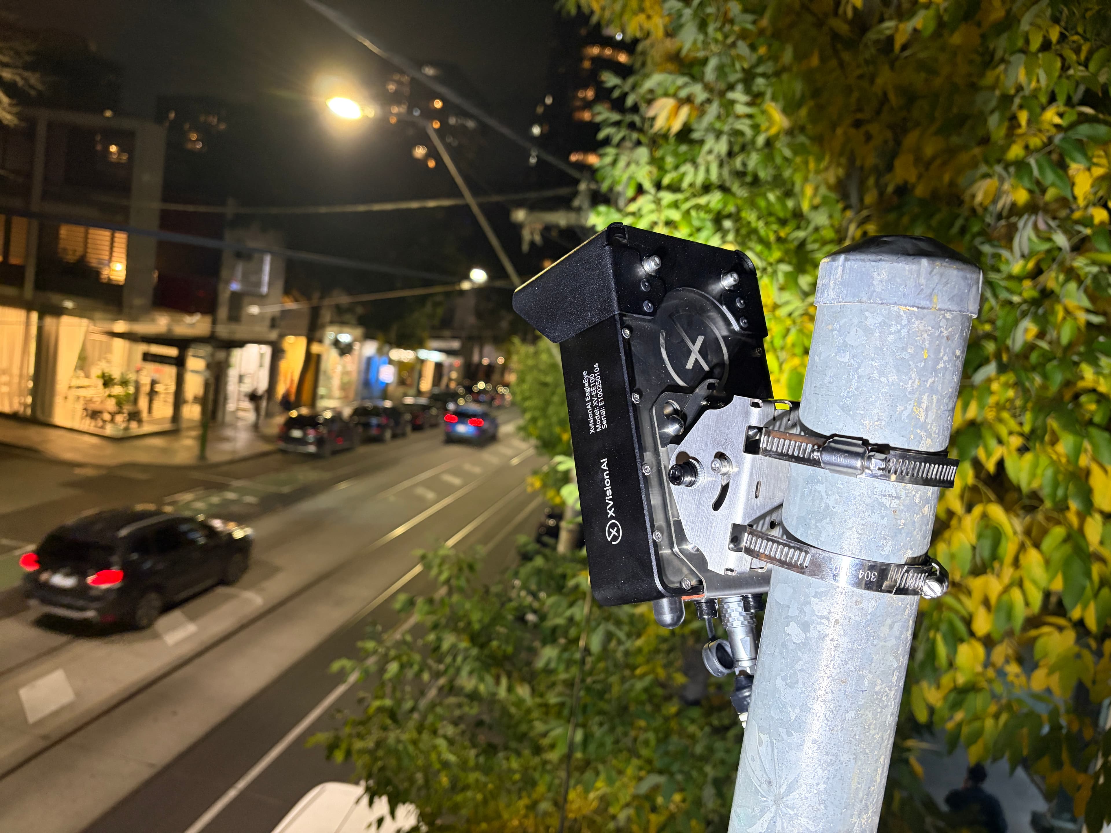
Start with the data and hardware already available for one priority location. Add XVision intelligence where visibility is missing, then extend Command across more locations and teams.

From one deployment to a municipality-wide road intelligence network.
What began on Melbourne's Chapel Street corridor became a long-term intelligence platform supporting traffic operations, road safety, active transport and investment decisions across the City of Stonnington.
- In operation
- 7+ yrs
- Roadside units
- 40+
- Deployment model
- Permanent + temporary
Evidence in use
- Data and evidence informing 30 km/h speed recommendations to state authorities
- Support for shared-zone and cycling-path upgrades and investment
- Evidence of risk and dangerous road-user behaviours
- Movement, utilisation and risk evidence supporting the implementation and evaluation of the City of Stonnington Cycling Strategy 2020–2025
Connect the sources you already have
Use the data you already have. Add intelligence where you need it.
Command brings existing CCTV, traffic counts, connected vehicle data, GIS layers, uploaded video and field observations together around each road location. Teams can start with the sources already available, then add XVision hardware where visibility is missing.
Every input retains its location, time and source, so teams can move from raw information to finding, evidence and engineering report without rebuilding the work across separate systems.
Connect your data sourcesTRAFFIC DATA
Counts · Speed · Classification · Connected vehicle data
VIDEO & IMAGERY
Existing CCTV · Uploaded footage · Mobile video
LOCATION CONTEXT
GIS layers · Asset records · Field observations
XVISION INTELLIGENCE
EagleEye · Scout · Outpost
Command
One location · One investigation · One evidence trail
Use existing sources first. Add XVision intelligence where the answer needs more.
Every source · One location recordWorks with your transport data.
Fits your technology environment.
Command works with the traffic data, video and mapping systems already in use. Its identity, access, integration, export and retention controls can be configured around the organisation's technology and governance requirements.
- Identity & single sign-on
- SAML 2.0 · OIDC · MFA
- Roles & permissions
- RBAC · team permissions
- Audit trail
- User · time · action · export
- Browser compatibility
- Modern browsers · no desktop install
- Device access
- Desktop · tablet · mobile
- API & webhooks
- REST API · JSON · webhooks
- Traffic data
- Counts · speed · classification · external datasets
- GIS & mapping
- GIS layers · GeoJSON · map services
- Video sources
- Existing CCTV · live streams · uploads
- Evidence & reporting
- CSV · video · engineering outputs
- Data protection
- Encrypted in transit & at rest
- Hosting & data residency
- In-country hosting
Connect to the organisation's identity provider and apply existing sign-in and MFA policies.
Control who can view, investigate, edit, export and administer information across teams.
Preserve a traceable record of investigation changes, evidence activity and exports.
Access Command through supported web browsers without deploying a dedicated desktop application.
Support office-based investigation work and responsive field inputs across common devices.
Exchange approved data with existing transport platforms, data stores and downstream applications.
Bring survey outputs and approved third-party traffic datasets into the location record.
Use existing mapping context while retaining location against every investigation and evidence item.
Connect approved camera sources and combine them with footage uploaded by teams or third parties.
Export approved data, evidence packages and reporting outputs for review, sharing or archive.
Protect connected data, investigation records and stored evidence throughout the deployment.
Data is hosted in the country where it is collected and is not transferred offshore.
Final compatibility, identity, API, security and retention requirements are confirmed during solution design.
Start with one road location
Bring us one traffic question. We'll show you how to answer it.
Share the location, the question and the data already available. We'll map how Command can organise the investigation, connect the evidence and produce a defensible engineering report—then identify where XVision hardware can fill any gaps.