
Resource Library
Why Measuring Risk Requires Depth, Not Just Detection
By Xvision Engineering
- Safety Risk
- Evidence Frameworks
- Near-Miss Detection
- Location Intelligence
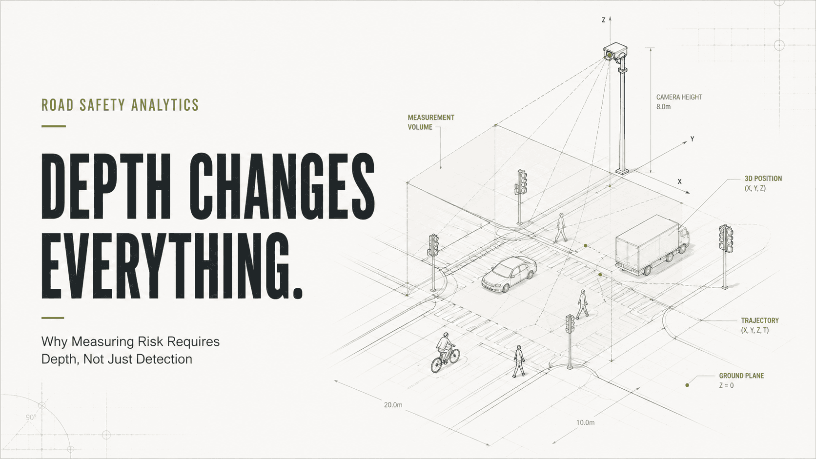
Detecting a road user is easy. Understanding risk is much harder.
Over the past decade, computer vision has transformed the way transport agencies observe their networks.
Modern systems can reliably detect vehicles, pedestrians, cyclists and other road users in real time. What was once a labour-intensive process requiring manual surveys can now be automated continuously across entire intersections and corridors.
As a result, detection accuracy has become one of the most commonly discussed metrics in roadside analytics.
But detection alone does not measure risk.
Knowing that a pedestrian exists within a scene is useful. Knowing precisely where that pedestrian is, how they are moving through space and how they relate to other road users is what ultimately enables meaningful safety analysis.
This distinction is becoming increasingly important as road authorities look beyond traffic counts and crash history towards conflict analysis, near-miss detection and proactive safety management.
The challenge is that measuring risk requires more than identifying objects.
It requires understanding spatial relationships.
Detection Answers One Question
Most computer vision systems are designed to answer a relatively simple question:
What is it?
Is it a vehicle?
A cyclist?
A pedestrian?
A motorcycle?
For many transport applications, that information is sufficient.
- Traffic counts.
- Vehicle classification.
- Turning movement counts.
- Origin-destination analysis.
These applications primarily depend on identifying road users correctly.
The exact position of the object may be less important than the fact that it was detected.
Risk analysis is different.
The question is no longer:
What is it?
The question becomes:
Where is it, how is it moving, and what is likely to happen next?
Risk Lives In The Relationship Between Road Users
A near miss is not defined by a vehicle.
A near miss is defined by the relationship between two or more road users.
A conflict occurs because trajectories intersect.
A collision occurs because space and time overlap.
The quality of risk analysis therefore depends on understanding:
- Position
- Distance
- Speed
- Direction
- Relative motion
- Proximity
These are fundamentally spatial measurements.
Without reliable spatial information, it becomes difficult to determine whether two road users are genuinely interacting or simply appear close together within an image.
Key Principle
Detection identifies road users.
Depth explains their relationship.
The Problem With 2D Estimation
Many vision systems operate primarily within a two-dimensional image plane.
While sophisticated techniques can estimate distance and motion from a single camera, these approaches ultimately rely on assumptions about perspective, scale and object behaviour.
In simple environments, these assumptions may be acceptable.
In complex intersections, they become more challenging.
For example, two vehicles may appear very close together within an image.
In reality they may be:
- Several metres apart
- Travelling on different approaches
- At different elevations
- Not interacting at all
Similarly, two road users that appear distant within an image may actually be approaching a conflict point at high speed.
The image alone does not always provide enough information to understand the true geometry of the interaction.
This becomes increasingly important when the objective is measuring risk rather than simply detecting objects.
Sometimes a severe reaction from one driver can make a near miss look severe when in fact it has a low risk, and sometime the reverse may be true. Without spatial understanding it is subjective to the actual risk and consequence.
Why Depth Matters
Depth provides a direct understanding of where road users exist within physical space.
Rather than estimating relationships from image appearance alone, a depth-aware system can measure them.
This creates several important advantages.
More Accurate Trajectories
Trajectory reconstruction becomes more reliable because movement is measured within real-world coordinates rather than inferred from image movement.
Better Speed Estimation
Speed calculations become less dependent on perspective assumptions and camera calibration models.
Improved Conflict Detection
Potential interactions can be assessed using actual spatial relationships rather than apparent proximity within an image.
More Reliable Safety Metrics
Metrics such as PET and TTC depend heavily on accurate positional information.
Improved spatial understanding generally leads to improved confidence in these calculations.
Why This Matters For Near-Miss Detection
Near-miss analysis is fundamentally an exercise in understanding future outcomes.
The objective is not simply to identify that two road users were present.
The objective is to determine:
- How close they came to colliding
- How quickly the interaction developed
- How severe a collision may have been
- Whether intervention was required
These questions depend on geometry.
A system that understands position and depth can evaluate interactions far more effectively than a system relying solely on object detection.
The result is not merely better analytics.
The result is more meaningful safety evidence.
Beyond Detection: Understanding Conflict
Many discussions around computer vision still focus on detection accuracy.
How many vehicles were identified?
How many pedestrians were detected?
How often was the classification correct?
These remain important questions.
However, as transport agencies increasingly adopt proactive safety frameworks, a new set of questions is emerging.
- Where are conflicts occurring?
- Which interactions present the highest risk?
- How severe are those conflicts?
- Which locations should be prioritised for intervention?
Answering these questions requires moving beyond detection and towards spatial understanding.
The future of road safety analytics will not be defined by identifying more objects.
It will be defined by understanding how those objects interact.
Detection vs Risk Analysis
Detection asks:
✓ What is it?
✓ How many are there?
✓ What type of road user is it?
Risk analysis asks:
✓ Where is it?
✓ How fast is it moving?
✓ What is it interacting with?
✓ How likely is a conflict?
✓ How severe could the outcome be?
The Future Of Infrastructure Intelligence
Road authorities have become exceptionally good at measuring traffic operations.
Increasingly, they are seeking the same level of sophistication in road safety.
That shift requires more than detecting road users.
It requires understanding their behaviour, their relationships and the risks that emerge when their paths intersect.
The future of infrastructure intelligence is not simply knowing what is happening.
It is understanding what is likely to happen next.
And that begins with depth.
Because measuring risk requires more than detection.
It requires spatial understanding.