
Resource Library
A Raised Intersection Is Not the Outcome
By Simon Maselli
- raised safety platforms
- intersections
- pedestrian safety
- Safe System
- road safety
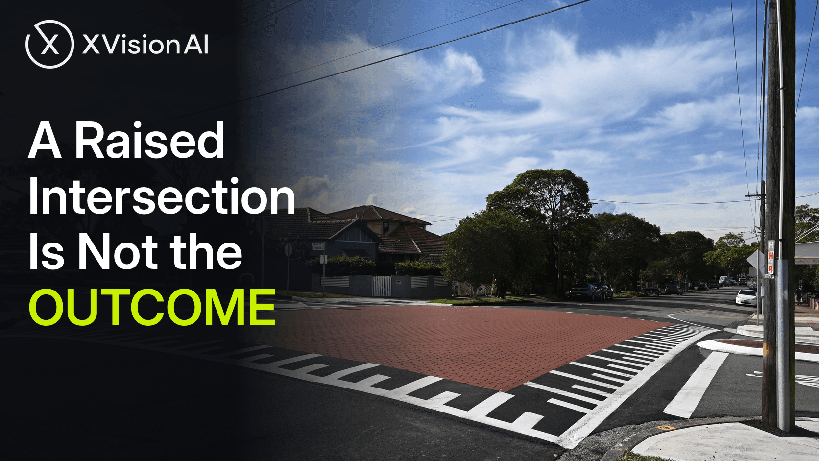
Australia is turning raised safety platforms from a novel trial into a standard intersection treatment. Victoria’s Department of Transport and Planning has issued Road Design Note 03-07 Version 4.0, placing raised platforms among accepted practice at intersections and low-speed mid-block sites. Transport for NSW has published TS 00143 for mass-action use on Main Streets and Main Roads. City of Sydney has raised signalised platforms at Macleay Street and Greenknowe Avenue in Potts Point and at Portman Street and Merton Street in Zetland. Pedestrian deaths, meanwhile, rose 16.4 per cent in the 12 months to 31 March 2026. The gap is not another design note. It is the ability to treat each raised intersection as a location — to ask what is happening here, decide what to do, see what changed after the platform went in, and compare it with the rest of the network.
The treatment wave is real. The location clock is not.
Raised safety platforms are elevated pavement sections that slow vehicles at conflict points with a gentler ramp than a traditional hump. At arterial signals they appear as approach platforms (raised stop bars) or as a fully raised intersection flush with the footpath. Austroads’ Effectiveness and Implementation of Raised Safety Platforms (AP-R642-20) documented the Australian and New Zealand community of practice building on Dutch experience, with Victoria leading higher-speed signalised applications above 50 km/h.
The named sites are no longer theoretical. Austroads’ sample investigations covered High Street and Dalton Road in Thomastown, Plenty Road at Whittlesea–Yea and Wallan Roads in Whittlesea, Bass Highway at McKenzie Street in Wonthaggi, and Surf Coast Highway at Kidman Avenue in Belmont. Freight arterials are in the mix: Surf Coast Highway Belmont and Bass Highway Wonthaggi carry commercial traffic that once made agencies hesitate. South Australia’s raised T-junction at Rundle Street and The Parade West in Kent Town, and City of Sydney’s platforms at Potts Point and Zetland, show the treatment moving into high-pedestrian main streets as well as peri-urban arterials. Safe System Solutions has counted more than 18 large signalised raised intersections in Victoria alone.
A program can count platforms poured, design notes published and advisory 40 km/h signs erected. It cannot tell a road safety engineer whether Dalton Road still behaves like High Street six months later, or whether the Potts Point platform changed the conflict pattern that justified the streetscape upgrade.
Crash history gets you the treatment. It does not close the loop.
The National Road Safety Strategy 2021–30 asks governments to halve road deaths by 2030. In the 12 months to 31 March 2026, the Australian Automobile Association’s benchmarking showed 1,326 people died on Australian roads — 3.0 per cent higher than the previous corresponding period, and 20.9 per cent higher than when the Strategy began. Pedestrian deaths rose from 171 to 199. No jurisdiction is on track. Serious-injury progress remains unmeasurable nationally for want of data. Against that backdrop, NRSS infrastructure guidance and NSW’s 2026 Road Safety Action Plan keep pointing at the same class of place: urban intersections and local streets where raised platforms, safer speeds and pedestrian facilities are meant to cut trauma.
The evidence base for the treatment itself is strong enough to justify the wave. Austroads AP-R642-20 summarised Dutch work showing roughly 40 per cent fewer casualty crashes at signalised platforms, and Australian before–after speed work at Thomastown found a 13 km/h (28 per cent) reduction in mean approach speed and an 8 km/h reduction on departure across seven treated intersections. A controlled 12-month evaluation of raised platforms at high-volume intersections reported a 15.6 per cent reduction in central tendency of speed and estimated substantial drops in the odds of exceeding 30, 40 and 50 km/h. A five-year crash look-back at the High Street Thomastown corridor has since reported a 60 per cent reduction in people seriously injured and an 83 per cent reduction in intersection crashes — with rear-ends falling from 18 to 12 rather than rising as feared.
Those results are why Version 4.0 of Victoria’s design note and NSW’s TS 00143 exist. They are also why a platform cannot be mistaken for an outcome. Austroads itself noted that isolating platform effects from concurrent signal, lighting and layout changes is hard, that late braking can appear at new sites and then fade, and that longer observation is needed to separate lasting effect from novelty. A design note standardises how to build. It does not answer whether this location got safer after construction.
Austroads’ Keeping People Safe When Walking work (March 2025) makes the same point from the pedestrian side: proven interventions could cut fatalities and serious injuries by 70–90 per cent, yet exposure and safety performance indicators remain too weak to prioritise and prove well. The raised intersection is where that weakness becomes concrete. Each platform is a place with a before picture, an intervention, and — if anyone closes the loop — an after picture.
What the evidence has to show after the pour
The useful question at a raised intersection is not “did we install the treatment?” It is: what is happening at this location during the hours the conflict is meant to be managed?
On High Street in Thomastown, the corridor treatment answered a corridor question with corridor works. Crash totals describe the route. They do not, by themselves, describe whether pedestrians still cross mid-block between platforms, whether approach speeds hold after the first year, or whether freight movements shifted onto an untreated parallel street. On Surf Coast Highway at Kidman Avenue, Belmont, early evaluation showed mean and 85th percentile speeds through the intersection well below nearby controls. That is a strong first after picture. It is not a permanent one. On Macleay Street at Greenknowe Avenue in Potts Point, the platform sits inside a high-pedestrian streetscape. The after picture has to include whether people walking and cycling use the continuous level, and whether drivers still arrive at Safe System speeds when the novelty has worn off.
Existing systems are necessary and still insufficient. SCATS and STREAMS describe signal timing around the intersection, not whether vertical deflection is still suppressing the speed that produces severe side-impact and pedestrian trauma. CCTV confirms an incident after it is reported. Connected-vehicle feeds describe circulating traffic, not the desire line from the footpath flush with the platform to the far kerb. None of that substitutes for location evidence at the intersection itself: approach and departure speeds, conflict patterns, pedestrian and cyclist use of the raised surface, and what changed after the works.
Question, evidence, decision, intervention, outcome, benchmark
Once the location is visible, the workflow is the one a competent traffic engineer already uses. It is simply rarely closed.
Question. Is this intersection still operating above Safe System collision speeds for the road users present? Are pedestrians and cyclists using the continuous level, or a desire line the design did not intend?
Evidence. See what happened at that location across a run of peaks, weekends and freight windows. Put vehicle approach speeds, turning conflicts and pedestrian desire lines on the same picture — before the pour and after it.
Decision. Choose the form that matches the place: approach platforms on a divided arterial, a fully raised intersection on a main street, a softer ramp for a heavy-vehicle route, or a package with speed, delineation and crossing facilities. Victoria’s RDN 03-07 and NSW’s TS 00143 supply the design language. The missing input is which option this location needs.
Intervention. Deliver it through the program that already exists — Safe System Road Infrastructure Program works, a council streetscape, a Movement and Place upgrade — without treating the pour itself as the proof.
Outcome. Go back to the same location and see what changed. Did mean and 85th percentile speeds hold? Did serious injury crash patterns move? Did rear-ends spike, as feared, or fall, as High Street’s longer look-back suggests? A platform installed is an output. A change in how the location behaves is an outcome.
Benchmark. Compare this raised intersection with the others on the same corridor and with similar sites across the network. High Street should teach Dalton Road. Belmont should inform Wonthaggi. Potts Point should inform the next City of Sydney main street. Without that comparison, every platform stays a one-off story.
Sources
- Australian Automobile Association, Benchmarking the Performance of the National Road Safety Strategy, March Quarter 2026.
- Austroads, Effectiveness and Implementation of Raised Safety Platforms, AP-R642-20, November 2020.
- Austroads, Keeping People Safe When Walking – Stream 1: Recommended Pedestrian Safety Interventions, AP-R730-25, March 2025.
- Department of Transport and Planning (Victoria), Road Design Note 03-07 Raised Safety Platforms, Version 4.0, December 2025.
- Transport for NSW, TS 00143 Raised Safety Platforms – Use at Intersections, February 2025.
- Transport for NSW, 2026 Road Safety Action Plan.
- National Road Safety Strategy 2021–30, Infrastructure planning and investment fact sheet.
- Budzynski et al., “Evaluation of Raised Safety Platforms (RSP) On-Road Safety Performance,” Sustainability, 2022 (controlled before–after speed evaluation).
- Movement and Place NSW, Raised safety platforms design solution (Macleay Street / Greenknowe Avenue, Potts Point; Portman Street / Merton Street, Zetland).
- Safe System Solutions, “Raised intersections on arterial roads” / RSP practice notes (Victoria site count and case summaries including Surf Coast Highway Belmont, Bass Highway Wonthaggi, The Boulevard Ivanhoe East).
XVision helps transport teams keep that loop closed at the location — evidence before the works, evidence after, and a way to compare what worked across the network — using the systems and deployments already on the road.